Introduction
EOxCloudless is a global, cloud-free imagery product series derived from Copernicus Sentinel-2 satellite data. It provides high-quality, consistent visual representations of the Earth’s surface suitable for a wide range of applications, including cartography, environmental monitoring, and geospatial analysis. EOxCloudless products are generated through a semi-automatic processing workflow that prioritizes visual consistency and data clarity by filtering out clouds, shadows, and artifacts.
The core input data is sourced from Sentinel-2 reflectance imagery. These images are systematically filtered and composited based on pixel quality scores (such as cloud probability, radiometric quality, etc.) and temporal coverage. The process involves analyzing multiple observations per location and selecting pixels with minimal cloud contamination and optimal illumination conditions, typically from a defined time range within a calendar year.
Each product is based on a global tiling system aligned with standard geospatial grid systems. The imagery is mosaicked to ensure consistent color balancing across regions and seasons. EOxCloudless offers high spatial detail with the 10-meter resolution of Sentinel-2 imagery, making it suitable for detailed visualization across urban, rural, and natural landscapes.
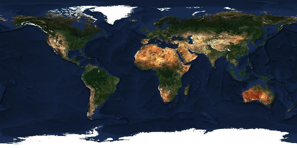
The resulting global mosaics aim to depict a visually intuitive and seasonally consistent representation of the Earth, facilitating interpretation by end users. Products are aligned to well-defined time spans—often calendar years or seasonal periods—enabling comparison across time and between datasets. The processing pipeline emphasizes automated cloud removal, BRDF correction and visual quality control without applying complex radiometric corrections that may obscure surface appearance.
EOxCloudless supports use cases where visual clarity, geographic coverage, and long-term consistency are more important than high spectral accuracy. It is used in public and commercial services, including basemaps, monitoring portals, simulations and other GIS applications that rely on easy-to-interpret Earth imagery.
The products are developed and maintained by EOX IT Services GmbH and are available under open data policies where applicable. More information and data purchase can be done at cloudless.eox.at.