Skip to content
Industries
Research & Education
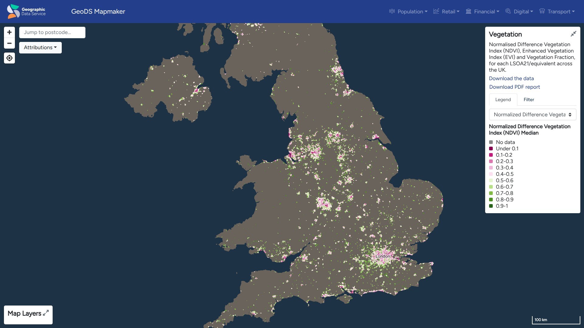
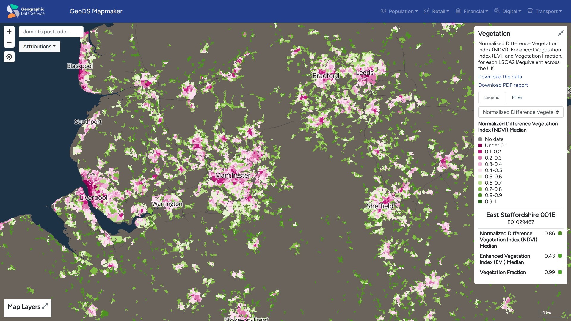
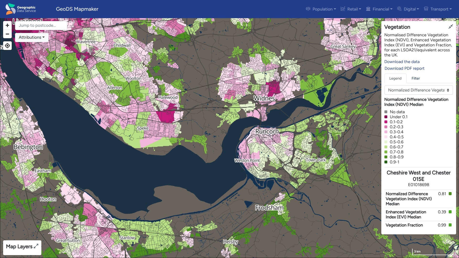
Academic institutions use EOxCloudless satellite imagery as a consistent data source for Earth observation research and geospatial education.
The University of Liverpool has incorporated EOxCloudless data into research workflows to calculate the enhanced vegetation index.
Students and researchers have access to preprocessed Sentinel-2 data, allowing them to focus on analysis rather than data wrangling.
This makes EOxCloudless a practical and credible foundation for a wide range of academic disciplines, from geography and ecology to urban studies and remote sensing.
Example: Liverpool University Geographic Data Service
Academic Use Cases
- GIS Training: A high-quality global dataset for teaching geospatial analysis.
- Public Projects: Ideal for university-led environmental advocacy programs.