Skip to content
Industries
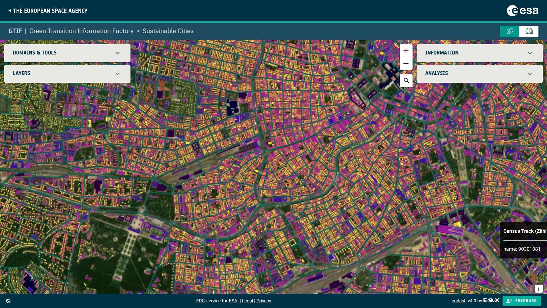
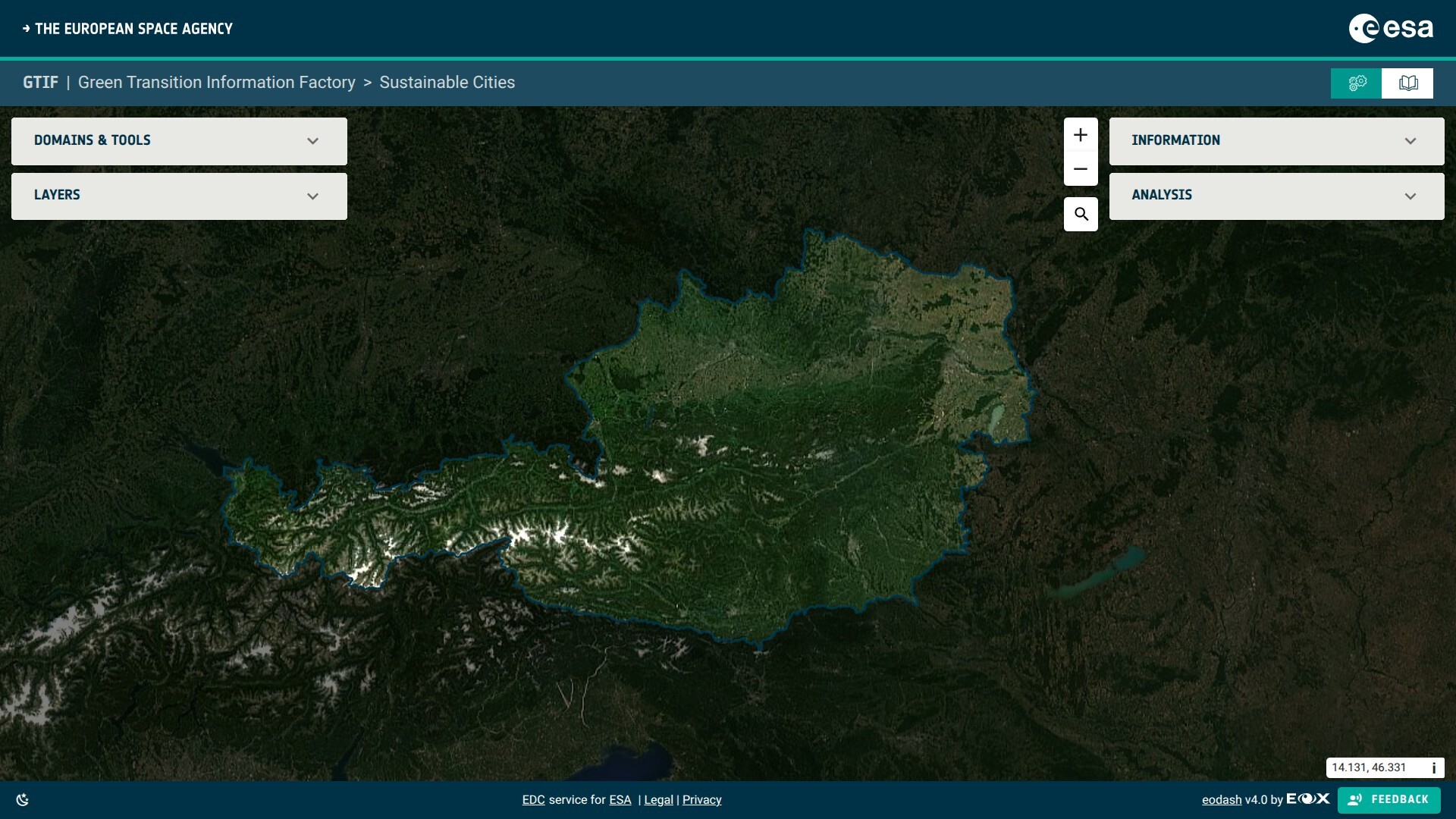
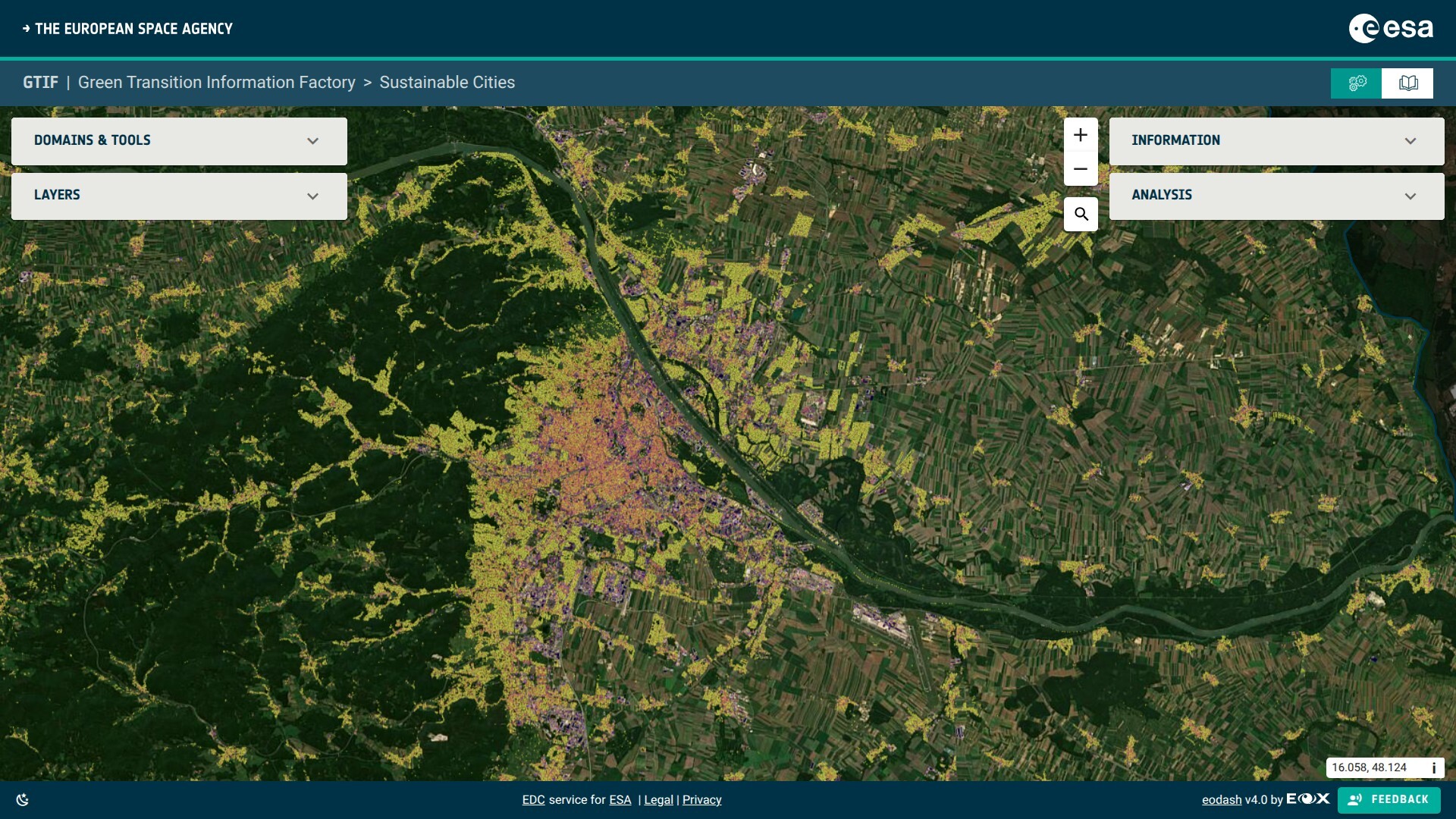
Urban Planning & Digital Twins
Urban planners and digital twin developers rely on accurate, consistent satellite imagery as the geospatial backbone for city models and simulations.
EOxCloudless offers clean, cloud-free basemaps needed to represent current land use, built-up areas, infrastructure, and urban development with high visual fidelity.
The 10-meter resolution of Sentinel-2 data offers a practical balance between detail and global coverage, making it suitable for large metropolitan areas as well as regional planning contexts. These tools can be hosted offline via various data formats, allowing for secure enterprise operations without requiring any external connectivity.
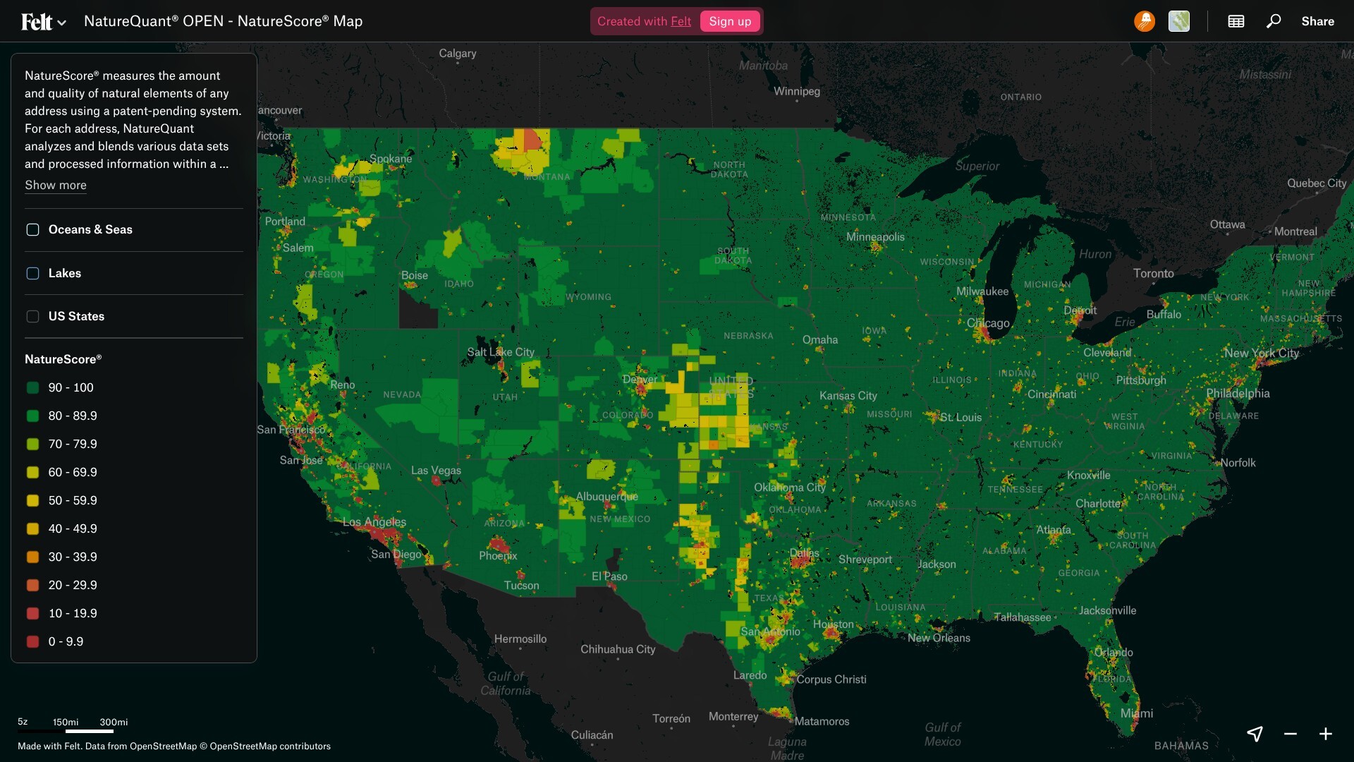
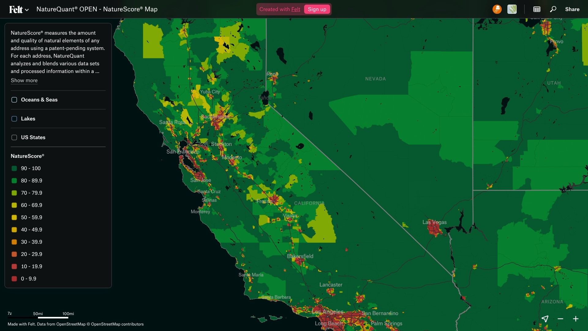
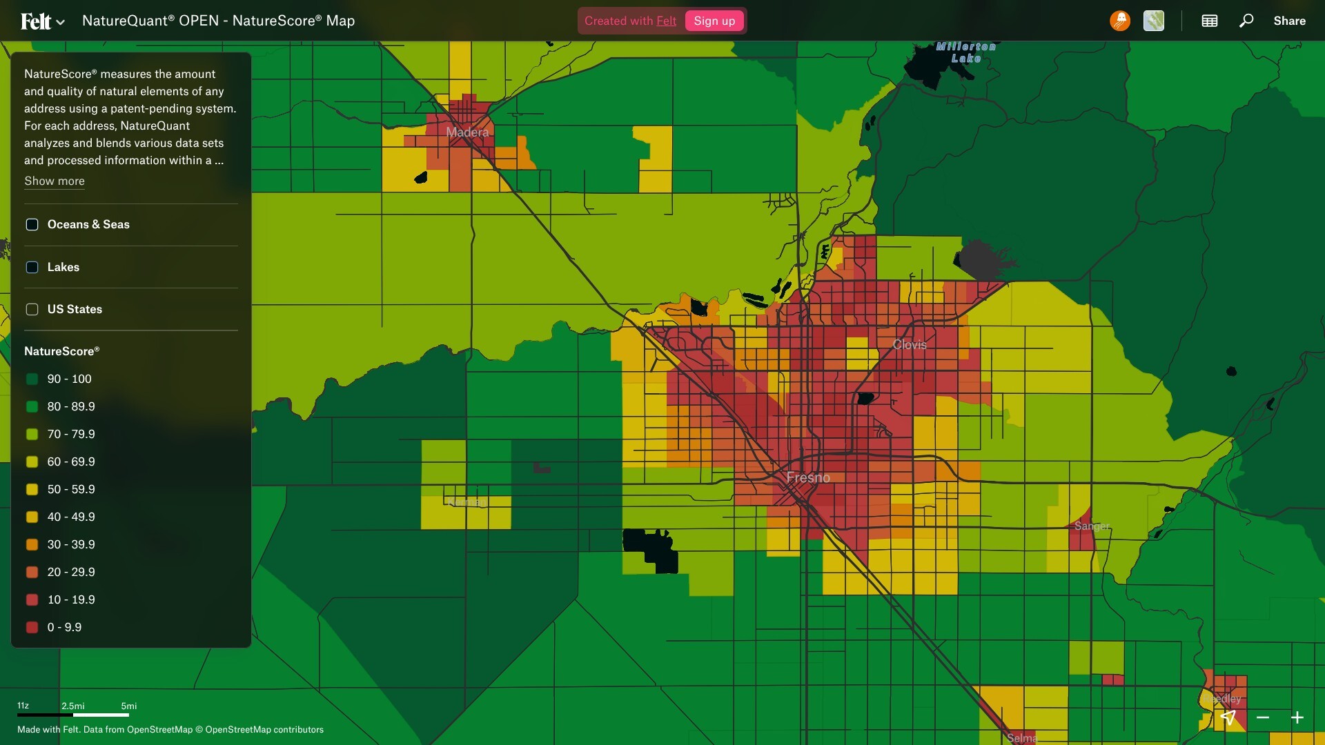
NatureQuant uses EOxCloudless to calculate and assess NatureScore® - it measures the amount and quality of natural elements at any address using their patented system.
Examples: GTIF, NatureQuant
Urban Solutions
- Digital Twins: Consistent globe-wide imagery for virtual city models.
- Land Use Analysis: Identify urban sprawl and green space requirements.